Legal classification
Class I Protection Forest Reserve (FR)
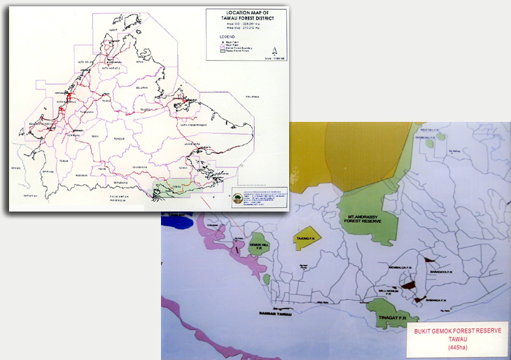
Area—Approx. 445 ha.
Location & access
The FR is less than 20 km north of Tawau town along Kuhara Road.
Access to the FR is at its northern end. From the main road, a
sealed road leads through an oil palm plantation to the Bukit Gemok
Nature Centre.
Infrastructure
The FR was developed first developed in 1992. Proper funding under
the 7th and 8th Malaysia Plans (1996-2005) were secured for
developing the FR for forest recreation and education. It now has a
large visitor centre (with offices, a very informative exhibition
hall, toilets and a VIP room), a resthouse, staff quarters, a
camping ground and a canopy walkway at the top of the hill.
History & management
Creation—First gazetted in 1949 with 1228 acres. In 1962, an areas
of 125 acres was partially dereserved. It was regazetted as Class I
FR in 14/3/1984.
Management responsibility—Tawau District Forestry Office.
Boundary matters—The boundary has yet to be demarcated.
Management plan—None.
Current use—None.
Settlements & adjacent land-use
Being close to Tawau town, there are also many housing estates in
the southeast. There are a few villages near the FR, namely Kg. Batu
Putih (northeast), Kg. Mutiara (northwest), Kg. Jambatan Putih
(east) and Kg. Imam (west). There are other villages in the north
along Kuhara-Table Road. There are also houses near the southern and
northeastern boundary, some of which are located within the FR
boundary. There is a secondary school nearby. The town of Tawau is
less than 7 km to the south.
Physical environment
Topography—The whole FR is mainly a large outcrop of basic and
intermediate igneous rocks. It is very steep. The peak of Gemok Hill
is about 396 m asl.
Hydrology—No river of note.
Soils—Mainly Tinagat and Apas Associations, with Brantian on the
low-lying areas in the southeast and southwest.
For soil map, click here.
Meteorological data—See Tiger Estate, Tawau Airport, Berumas, Sg.
Wakuba and Kalabakan data.
Map of met. stations Rainfall map
Vegetation
See current vegetation map here
See natural vegetation map here
See satellite image here
Vegetation surveys have not been carried out in the VJR. The
information below is interpreted from satellite imageries.
The main vegetation is mixed dipterocarp forest (MDF) and is largely
intact, probably due to the steepness of Gemok Hill. Although a
vegetation survey was not carried out for this FR, historical
information on the forests surrounding Tawau is available. Gemok
Hill can be classified as Type F mixed dipterocarp forest. The most
frequent species of this type is S. laevis. Other species of the
selangan Batu group found here include S. inappendiculata, S.
maxwelliana, S. foxworthyii and the hill form of S. superba.
Fauna
Macaques, barking deer and sambar deer have been sighted in the FR.
There are quite a number of bird species there, including a few
species of hornbills.
Education & Recreation
The main reason people visit this centre is for recreation. A canopy
walkway at the top of Gemok Hill serves as a major attraction. There
are campground facilities for the public to use. A large visitor
centre has been built under the 8th Malaysia Plan to support the FR
as a centre for recreation and education.
Threats & constraints
Encroachment—Villagers and school children can trek into the FR from
the south. However, there are no serious encroachment cases.
Special attributes
The canopy walkway on top of the hill is a major attraction among
the people of Tawau.
|