eTawau > Housing in Tawau > Bandar Sri Indah > River Esplanade

River Esplanade of Bandar Sri Indah

A footpath along the Babanga Stream, the only forest stream in the township — and what has happened to it since 2007

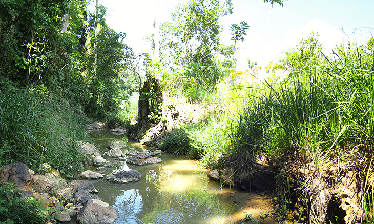
A clear, shallow forest stream running over rocks between steep green banks thick with ferns, grasses and trees.
The Babanga Stream beside the esplanade, when it still ran clear over the rocks.
WhereBandar Sri Indah, Tawau, Sabah — about 1 km from the Bandar Sri Indah shopping centre. Bandar Sri Indah is 17.2 km from Tawau, measured from the 0 km Tawau landmark.
BuiltStage 2 due for completion on 29 January 2007
FacilitiesA 6-ft-wide concrete footpath, an outdoor exercise station, shelters with barbecue stands, and benches
The streamThe Babanga Stream, flowing down from the Babanga Forest Reserve

A stream between two forest reserves

Bandar Sri Indah sits close to two protected forest reserves, Babanga and Membalua, yet it has only one forest stream: the Babanga Stream. There is no stream in the Membalua Forest Reserve; the water from Membalua Hill collects instead in a lake at the foot of the hill, a beautiful lake with an even wider variety of flying insects. There is no big river in Bandar Sri Indah at all. That made the Babanga Stream, with its clear water and the strip of forest beside it, home to a rich variety of insects.

The River Esplanade was built along it: gazebos, shelters and a jogging track beside a mountain stream, a few minutes from the shops.

A yellow Bandar Sri Indah signboard announcing the proposed construction of the River Esplanade, Stage 2: a 6-ft-wide concrete footpath, an outdoor exercise station, a shed and benches, completion date 29 January 2007.
The construction signboard for Stage 2, due to be completed on 29 January 2007.
A direction signboard at a roundabout in Bandar Sri Indah, with a welcome in Chinese at the top, pointing the way to SMK Visi and SK Visi, the multi-purpose hall, the residential phases, the Hap Seng Group offices, the shops, the Eco Park and the BSI Esplanade.
The direction board at the roundabout: the esplanade is on the right, past Phase 1.

Then and now

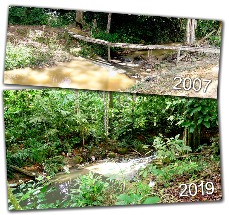
Soon after it opened, the esplanade was a popular family picnic ground. By 2019 it had become overgrown, the shelters stood among young trees and undergrowth, and it was a place for mosquitoes rather than picnics. The pairs of photographs below were taken twelve years apart.

Two photographs of the outdoor exercise station. In 2007 the brightly painted equipment stands on bare, open ground with new houses behind. In 2019 the same equipment stands under a curved roof, surrounded by grass and young trees.
The outdoor exercise station, 2007 and 2019.
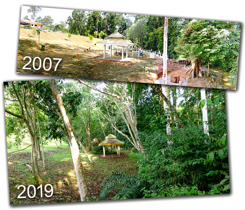
Two photographs of the picnic shelters. In 2007 a thatched gazebo and barbecue stands stand on open, newly cleared ground. In 2019 the gazebo is almost hidden among tall trees and thick undergrowth.
The shelters and barbecue stands, 2007 and 2019. Once a family picnic ground; by 2019, mostly visited by mosquitoes.
Two photographs of the Babanga Stream. In 2007 a muddy brown stream runs between bare banks with a fallen log across it. In 2019 the same stretch is enclosed by dense green vegetation, with water still flowing over the stream bed.
The Babanga Stream, 2007 and 2019: bare banks after construction, then twelve years of regrowth.
A panorama of the newly opened esplanade: brightly painted exercise equipment and a lookout tower on open ground, with a row of canopy tents and new houses behind.
The esplanade when it was new.
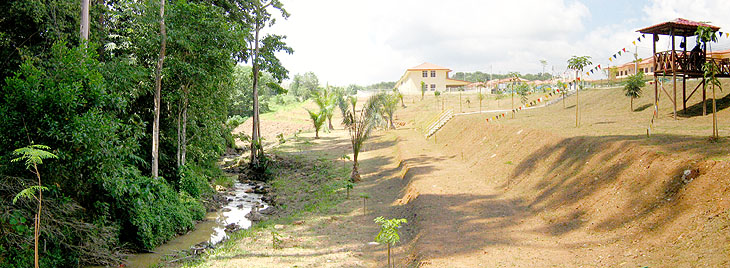
The stream running in a channel between a strip of forest on the left and freshly landscaped open ground on the right, with a lookout tower and houses in the distance.
The stream beside the new landscaping.
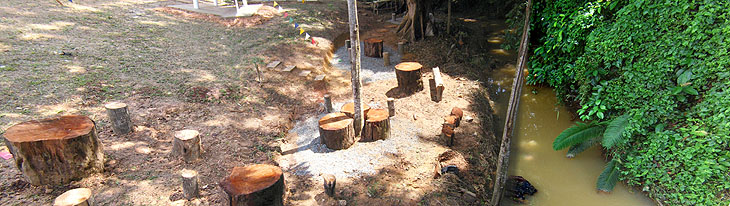
Tree-stump seats set on bare earth beside the brown water of the stream, with forest on the far bank.
Tree-stump seats beside the water.
The stream has dried up. In 2014 the Babanga Stream was still flowing with clear water from the hills. By 2026 it had dried up, and much of the life along the esplanade has gone with it. The photographs on this page, and the wildlife records below, are now a record of a stream that no longer runs.

What lived along the stream

7 June 2014 · 2.49 pm · beside the stream

A weevil with a straight nose

A long, slender black straight-snouted weevil crawling on a green leaf
A straight-snouted weevil, family Brentidae: long and thin as a matchstick, with a snout and straight, bead-like antennae. Photographed while the stream was still flowing.

A dragonfly with a black body marked in pale blue and large blue eyes, perched on a green leaf with its clear wings spread.
A male dragonfly perching beside the stream.
A pale, patterned butterfly chrysalis hanging from a thin brown twig.
The pupa of a black butterfly, beside the stream.
A pale green huntsman spider with long banded legs spread flat on the underside of a green leaf.
A rare green huntsman spider, Heteropoda sp. (Sparassidae), from the nearby Babanga Forest Reserve. Body about 2 cm, leg span 5 cm.

More about Bandar Sri Indah

About this page. Photographs by Wong Fook Yee, 2007–2019. Distances from Tawau on this site are measured from the 0 km Tawau landmark using Google Maps. Rewritten 25 September 2026. Corrections to editor@etawau.com.