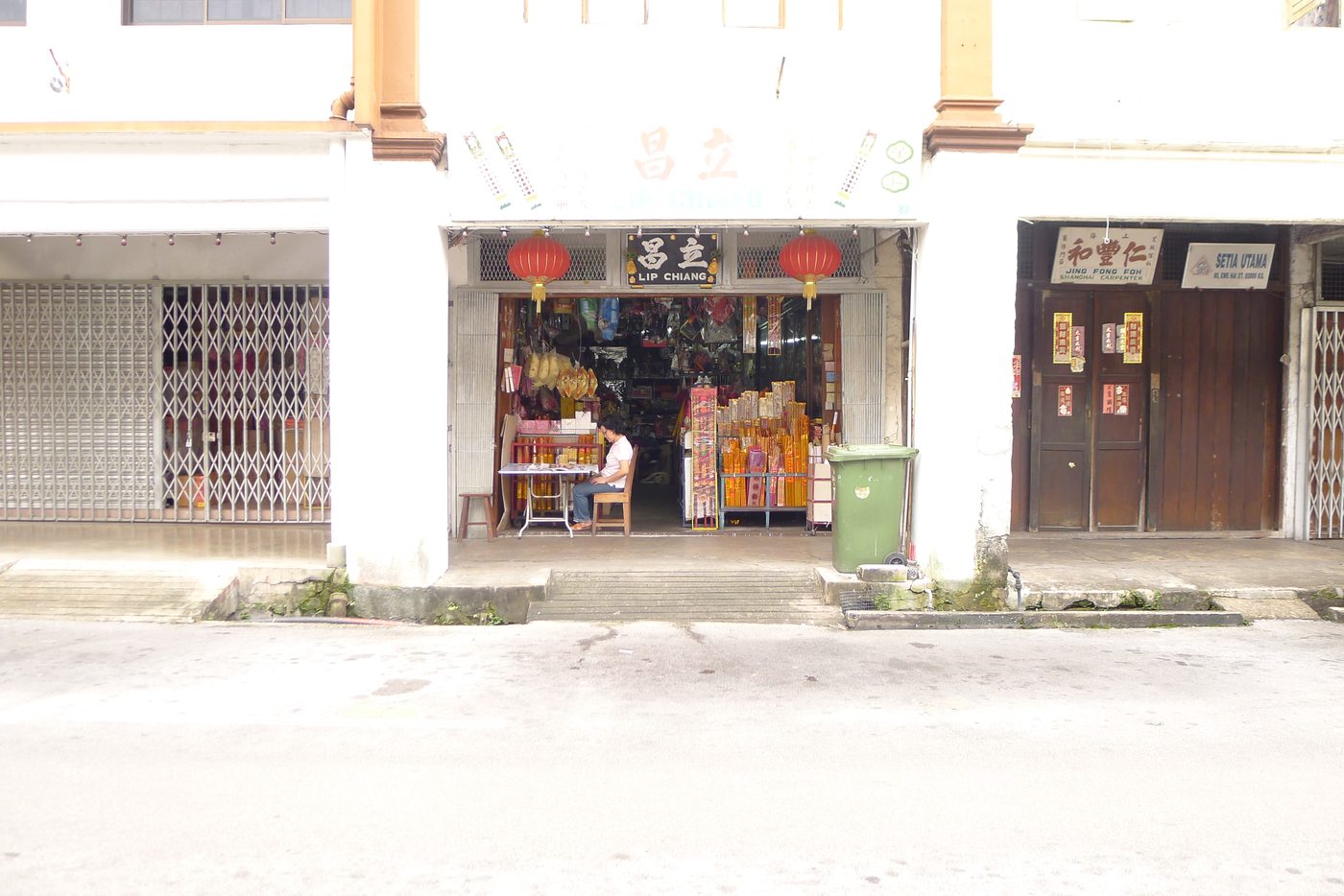
Photo: 攝影:Foto: Wong Fook Yee黃福裕Wong Fook Yee, 4 Feb 2013
City · Kuching Division · Sarawak城市 · 古晉省 · 砂拉越Bandar raya · Bahagian Kuching · Sarawak
Kuching古晉Kuching
古晉A river town of nipah huts that became the capital of Sarawak由河邊亞答屋聚落發展成砂拉越首府的城市Penempatan pondok nipah di tepi sungai yang menjadi ibu negeri Sarawak
Status地位TarafCity since 1 Aug 19881988年8月1日升格為市Bandar raya sejak 1 Ogos 1988Kuching City Day古晉市日Hari Bandar Raya Kuching
Councils地方政府Pihak berkuasa tempatanDBKU (north) · MBKS (south)北市市政廳 · 南市市政局DBKU (utara) · MBKS (selatan)two councils, one city一市兩個市政機構dua majlis, satu bandar raya
Area面積Keluasanabout 431 km²約431平方公里kira-kira 431 km²369.48 + 61.53 km²; other figures exist369.48 + 61.53;另有不同數字369.48 + 61.53; ada angka lain
People (Census 2020)人口(2020年普查)Penduduk (Banci 2020)609,205Kuching District, not the city alone古晉縣,非單指市區Daerah Kuching, bukan bandar sahaja
River河流SungaiSarawak River砂拉越河Sungai Sarawakabout 120 km long全長約120公里kira-kira 120 km panjang
Rain雨量Hujanabout 4,200 mm a year每年約4,200毫米kira-kira 4,200 mm setahun
1
Where the city sits城市的地理位置Kedudukan bandar
Land & Water
Kuching grew on the Sarawak River at the south-western tip of Sarawak. The river is about 120 km long and drains about 1,500 km²; above the city it splits into the Sarawak Kanan and Sarawak Kiri. The city is low: its average height is about 8 m above the sea, and its highest point, Mount Santubong (810 m), stands about 35 km to the north. Rain is heavy — about 4,200 mm a year.
Kuching tumbuh di tebing Sungai Sarawak di hujung barat daya Sarawak. Sungai ini kira-kira 120 km panjang dengan kawasan tadahan kira-kira 1,500 km²; di hulu bandar ia bercabang kepada Sarawak Kanan dan Sarawak Kiri. Bandar ini rendah: purata ketinggiannya kira-kira 8 m dari paras laut, dan titik tertingginya, Gunung Santubong (810 m), terletak kira-kira 35 km ke utara. Hujan lebat — kira-kira 4,200 mm setahun.
The river is tidal. Below the barrage the tide can rise and fall by about 6 m. For more than a century Kuching flooded when heavy rain met a high tide. The worst flood on record was in 1963; later big floods came in February 2003, January 2004 and January 2009.
Sungai ini berpasang surut. Di hilir benteng, beza pasang surut boleh mencapai kira-kira 6 m. Lebih seabad Kuching dilanda banjir apabila hujan lebat bertembung dengan air pasang. Banjir paling teruk direkodkan pada 1963; banjir besar kemudian berlaku pada Februari 2003, Januari 2004 dan Januari 2009.
The barrage: a gate at the river mouth閘壩:河口的大門Benteng: pintu di muara sungai
The Sungai Sarawak Regulation Scheme built the Bako causeway (August 1993) and then a barrage of five radial gates with a 125 m shiplock and a bridge, finished in November 1997 at a cost of RM150 million. It began operating on 1 December 1997. Its jobs: to hold back tidal and river floods, to protect Kuching's water supply and to keep mud off the beaches at Santubong and Damai. Since then the barrage is the only outlet of the river basin.
Skim Pengawalan Sungai Sarawak membina tambak Bako (Ogos 1993) dan kemudian benteng lima pintu jejari dengan kunci kapal 125 m serta jambatan, siap November 1997 dengan kos RM150 juta. Ia mula beroperasi pada 1 Disember 1997. Tugasnya: menahan banjir pasang dan banjir sungai, melindungi bekalan air Kuching dan mengurangkan lumpur di pantai Santubong dan Damai. Sejak itu benteng ini satu-satunya saluran keluar lembangan sungai.
Sketch map drawn by eTawau — not to scale, positions approximateeTawau 繪製的示意圖 — 未按比例,位置為約略Peta lakaran eTawau — tidak ikut skala, kedudukan anggaran
Sources: 資料來源:Sumber: Wikipedia, "Kuching" (geography, climate); Frontiers in Water, 11 Nov 2022 (river length, catchment, barrage as only outlet); WIT Press paper on the barrage (6 m tidal range); Sarawak Rivers Board, SSRS general information; Sarawak Ministry of Transport, 2025 (operations from 1 Dec 1997); UNIMAS project report by Jong Swee Lek (flood years).
2
How the city grew城市如何發展Bagaimana bandar berkembang
1827A settlement is founded under the Sultanate of Brunei, by its representative Pengiran Indera Mahkota.汶萊蘇丹的代表 Pengiran Indera Mahkota 在此建立聚落。Penempatan diasaskan di bawah Kesultanan Brunei oleh wakilnya Pengiran Indera Mahkota.
1839James Brooke arrives. The town is a row of timber huts with nipah roofs along today's Main Bazaar.詹姆士·布洛克抵達。當時的市鎮只是今日海唇街一帶的一排亞答屋頂木屋。James Brooke tiba. Pekan ini hanya deretan pondok kayu beratap nipah di sepanjang Main Bazaar hari ini.
1841On 24 September Brooke is made Governor (Rajah); the town becomes the capital of the Brooke state.9月24日布洛克受封為總督(拉惹),此地成為布洛克政權的首府。Pada 24 September Brooke dilantik Gabenor (Rajah); pekan ini menjadi ibu negeri kerajaan Brooke.
1864Main Bazaar, the oldest street, is laid out as a row of shophouses.最古老的街道海唇街形成一排店屋。Main Bazaar, jalan tertua, dibina sebagai deretan rumah kedai.
1870–1879Charles Brooke builds the Astana (1870) and Fort Margherita (1879). In 1872 he renames the town, until then called "Sarawak", as Kuching.查爾斯·布洛克興建 Astana(1870)和瑪格烈達堡(1879)。1872年他把原名「砂拉越」的市鎮改名為古晉。Charles Brooke membina Astana (1870) dan Kubu Margherita (1879). Pada 1872 beliau menamakan semula pekan yang dahulu dipanggil "Sarawak" sebagai Kuching.
1884The Great Fire burns the shophouses between Carpenter Street and Main Bazaar. They are rebuilt in brick.古晉大火燒毀亞答街與海唇街之間的店屋,之後以磚重建。Kebakaran Besar memusnahkan rumah kedai antara Carpenter Street dan Main Bazaar. Ia dibina semula dengan batu bata.
1888A cholera epidemic; a well in China Street gives clean water.霍亂流行;中國街的一口井提供乾淨的水。Wabak taun; sebuah perigi di China Street membekalkan air bersih.
1941–1945Japanese forces take Kuching on 24 December 1941. The surrender is signed at Kuching on 11 September 1945.1941年12月24日日軍佔領古晉;1945年9月11日在古晉簽署投降書。Tentera Jepun menawan Kuching pada 24 Disember 1941. Penyerahan ditandatangani di Kuching pada 11 September 1945.
1946Sarawak becomes a British Crown Colony on 1 July; Kuching stays the capital.7月1日砂拉越成為英國直轄殖民地,古晉仍是首府。Sarawak menjadi Tanah Jajahan Mahkota British pada 1 Julai; Kuching kekal ibu negeri.
1953Kuching Municipal Council is formed (1 January).古晉市議會成立(1月1日)。Majlis Perbandaran Kuching ditubuhkan (1 Januari).
1963Malaysia is formed; Kuching remains the state capital.馬來西亞成立,古晉仍是州首府。Malaysia ditubuhkan; Kuching kekal ibu negeri.
1988City status on 1 August. The city is split: Kuching North (DBKU, a commissioner) and Kuching South (MBKS, a mayor).8月1日升格為市,並分為古晉北市(北市市政廳,由專員管理)與古晉南市(南市市政局,由市長管理)。Taraf bandar raya pada 1 Ogos. Bandar dibahagi: Kuching Utara (DBKU, pesuruhjaya) dan Kuching Selatan (MBKS, datuk bandar).
1993Kuching Waterfront opens on 4 September.古晉河濱公園於9月4日開放。Tebingan Kuching dibuka pada 4 September.
1997The river barrage starts work on 1 December.閘壩於12月1日啟用。Benteng sungai mula beroperasi pada 1 Disember.
2013On 1 January the Satok weekend market moves across the river to Medan Niaga Satok.1月1日沙督週末市場遷往河對岸的 Medan Niaga Satok。Pada 1 Januari pasar hujung minggu Satok berpindah ke Medan Niaga Satok di seberang sungai.
2017Darul Hana Bridge, for people on foot, opens on 11 November.行人專用的 Darul Hana 橋於11月11日開放。Jambatan Darul Hana untuk pejalan kaki dibuka pada 11 November.
2021UNESCO names Kuching a Creative City of Gastronomy — the first Malaysian city in the network.聯合國教科文組織列古晉為「美食之都」,是馬來西亞第一個加入創意城市網絡的城市。UNESCO menamakan Kuching Bandar Raya Kreatif Gastronomi — bandar pertama Malaysia dalam rangkaian itu.
2026The first hydrogen-powered ART line is due to start a pilot run in the fourth quarter (announced May 2026).首條氫能 ART 路線預定第四季試運行(2026年5月宣佈)。Laluan ART berkuasa hidrogen pertama dijadual mula operasi rintis pada suku keempat (diumumkan Mei 2026).
Why "Kuching"?為甚麼叫「古晉」?Mengapa "Kuching"?
Nobody knows for sure. A 1909 history of Sarawak says the town took its name from a small stream that ran through it into the main river; a 19th-century writer, Harriette McDougall, called that stream "Sungai Kuching". Other ideas: the Malay word kucing (cat); the mata kucing fruit tree, which gave its name to Bukit Mata Kuching; the Indian port of Cochin; or the Chinese 古井 "old well". eTawau does not choose between them.
沒有人能確定。1909年出版的一本砂拉越史書說,市名來自一條流經市區、注入大河的小溪;19世紀的作者麥杜嘉夫人(Harriette McDougall)稱這條小溪為「Sungai Kuching」。其他說法包括:馬來語 kucing(貓);mata kucing 果樹(Bukit Mata Kuching 山因此得名);印度港口科欽(Cochin);或華語「古井」。eTawau 不作取捨。
Tiada siapa tahu dengan pasti. Sebuah sejarah Sarawak tahun 1909 menyatakan pekan ini mengambil nama daripada anak sungai kecil yang mengalir melaluinya ke sungai utama; penulis abad ke-19, Harriette McDougall, memanggil anak sungai itu "Sungai Kuching". Pendapat lain: perkataan Melayu kucing; pokok buah mata kucing yang memberi nama Bukit Mata Kuching; pelabuhan Cochin di India; atau "perigi lama" 古井 dalam bahasa Cina. eTawau tidak memilih antara pendapat ini.
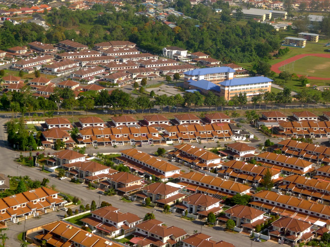
Tabuan Jaya from the air: rows of new terrace houses, a school and playing field — the city spreading east from the old town從空中看 Tabuan Jaya:一排排新的排屋、學校與運動場 — 城市從舊市區向東擴展Tabuan Jaya dari udara: deretan rumah teres baharu, sekolah dan padang — bandar berkembang ke timur dari pekan lama · Photo: 攝影:Foto: Wong Fook Yee黃福裕Wong Fook Yee, 24 Mar 2013
Sources: 資料來源:Sumber: Wikipedia, "Kuching" (1827, 1841, 1872, 1888, 1941–46, 1953, 1963 and the name theories, after Bampfylde & Baring-Gould 1909 and Ring & Salkin 1996); Malaysiakini (1839, 1884); The Edge, 2026 (Main Bazaar 1864); Sarawak Heritage Society list of gazetted heritage, May 2026 (Astana 1870, Fort Margherita 1879); Borneo Post, 1 Aug 2022 (city status); Wikipedia, "Kuching Waterfront"; Sarawak Tourism (Satok market move); Malay Mail, 12 Nov 2017 (bridge); The Star, 18 Nov 2021 (UNESCO); Borneo Post, 18 May 2026 (ART).
3
The people城市居民Penduduk
People & Land Use
Kuching is where Sarawak's peoples meet: Malays, Chinese, Bidayuh and Iban are the largest groups, with Melanau, Indians and others. In the 2020 Census, Kuching District had 609,205 people; 558,113 of them (92%) lived in urban areas. The bar shows religion in the district:
Kuching tempat bertemunya kaum-kaum Sarawak: Melayu, Cina, Bidayuh dan Iban kumpulan terbesar, bersama Melanau, India dan lain-lain. Dalam Banci 2020, Daerah Kuching mempunyai 609,205 penduduk; 558,113 orang (92%) tinggal di kawasan bandar. Bar di bawah menunjukkan agama di daerah ini:
Muslim伊斯蘭教Islam 40.6%Christian基督教Kristian 32.7%Buddhist佛教Buddha 24.6%Hindu, other, none or not stated印度教、其他、無宗教或未說明Hindu, lain-lain, tiada atau tidak dinyatakan 2.1%
The old heart of the city is different from the district as a whole. In the Bandar Kuching parliamentary seat — about 35 km² around the old town — 64.5% of the 116,280 people were Chinese and 34.6% Bumiputera in 2020. Across the river, Malay kampungs line the north bank opposite the Waterfront.
Pusat lama bandar berbeza daripada daerah secara keseluruhan. Di kawasan parlimen Bandar Kuching — kira-kira 35 km² di sekitar pekan lama — 64.5% daripada 116,280 penduduk ialah Cina dan 34.6% Bumiputera pada 2020. Di seberang sungai, kampung-kampung Melayu berderet di tebing utara bertentangan Tebingan.
Sources: 資料來源:Sumber: Department of Statistics Malaysia, Census 2020, via citypopulation.de (district total, urban, religion); Galen Centre, Community Health Report Card, Bandar Kuching, 2026, from DOSM data (seat figures); Wikipedia, "Bandar Kuching (federal constituency)" (area); eTawau, Vanishing Kuching (kampungs).
4
How the city makes a living城市的經濟生計Ekonomi bandar
People & Land Use
Kuching was a trading post for jungle produce. Today most people work in services — government, schools and universities, banks, shops and food — while the port and three industrial areas (Pending, Demak Laut and Sama Jaya) make and move goods.
古晉起初是森林產品的貿易站。今天大部分人從事服務業 — 政府機構、學校與大學、銀行、商店與餐飲;港口和三個工業區(Pending、Demak Laut 和 Sama Jaya)則負責生產與運輸。
Kuching bermula sebagai pos dagangan hasil hutan. Hari ini kebanyakan orang bekerja dalam sektor perkhidmatan — kerajaan, sekolah dan universiti, bank, kedai dan makanan — manakala pelabuhan dan tiga kawasan perindustrian (Pending, Demak Laut dan Sama Jaya) mengeluarkan dan menggerakkan barangan.
Photo wanted — Please email us eTawau@yahoo.com徵求照片 — 請電郵 eTawau@yahoo.comFoto diperlukan — sila e-mel eTawau@yahoo.com
Port港口Pelabuhan
Kuching Port古晉港Pelabuhan Kuching
Run by the Kuching Port Authority since 1961. Ships left the old Tanah Puteh wharf for Pending (opened 8 Sep 1988) and Senari (opened 24 Nov 1999), where containers are handled.
由1961年成立的古晉港務局管理。船隻從舊的 Tanah Puteh 碼頭遷往 Pending(1988年9月8日啟用)和處理貨櫃的 Senari(1999年11月24日啟用)。
Diurus oleh Lembaga Pelabuhan Kuching sejak 1961. Kapal berpindah dari dermaga lama Tanah Puteh ke Pending (dibuka 8 Sep 1988) dan Senari (dibuka 24 Nov 1999) yang mengendalikan kontena.
2025: a record 10.42 million tonnes and 325,000 TEU — up from 0.7 million tonnes in 1975.2025年創紀錄處理1,042萬噸貨物和32萬5千個標準貨櫃 — 1975年只有70萬噸。2025: rekod 10.42 juta tan dan 325,000 TEU — berbanding 0.7 juta tan pada 1975.
Industry工業Industri
Sama Jaya Free Industrial ZoneSama Jaya 自由工業區Zon Perindustrian Bebas Sama Jaya
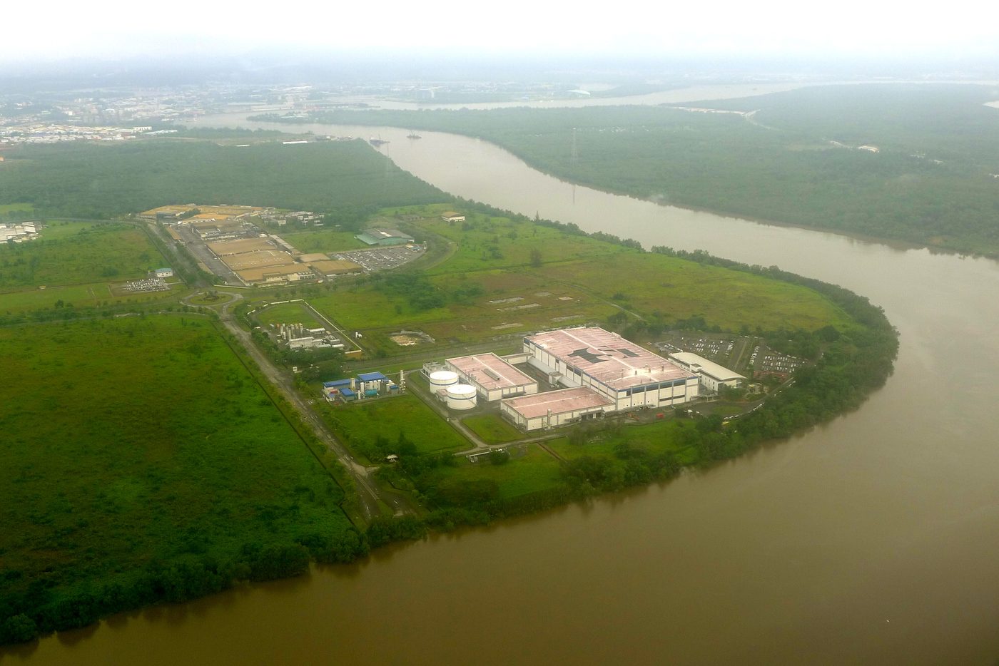
Set up by the state in 1991 for electronics: silicon wafers, hard-disk parts, solar cells and chips.
州政府於1991年設立,發展電子業:矽晶圓、硬碟零件、太陽能電池與晶片。
Ditubuhkan oleh negeri pada 1991 untuk elektronik: wafer silikon, komponen cakera keras, sel solar dan cip.
By 2025: about RM15.4 billion invested and more than 15,000 jobs.至2025年:投資約154億令吉,創造逾1萬5千個職位。Setakat 2025: pelaburan kira-kira RM15.4 bilion dan lebih 15,000 pekerjaan.
Medan Niaga SatokMedan Niaga Satok 市場Medan Niaga Satok
The weekend market that began in the city centre and grew up on Jalan Satok moved across the river on 1 January 2013. Jungle ferns (midin), wild fruit, salted terubok fish and forest honey are sold beside farm produce.
Pasar hujung minggu yang bermula di pusat bandar dan berkembang di Jalan Satok berpindah ke seberang sungai pada 1 Januari 2013. Pucuk midin, buah hutan, ikan terubok masin dan madu hutan dijual bersama hasil ladang.
Traders: 1,251 (minister, Jan 2014) or about 2,500 (The Star, Dec 2014) — the counts differ.攤商數目:1,251(部長,2014年1月)或約2,500(星報,2014年12月)— 兩者不同。Peniaga: 1,251 (menteri, Jan 2014) atau kira-kira 2,500 (The Star, Dis 2014) — angka berbeza.
In November 2021 UNESCO accepted Kuching into its Creative Cities Network as a City of Gastronomy, after an application by Kuching South City Council. It was the first Malaysian city in the network. UNESCO's note links Kuching's food to the biodiversity of Borneo — the same forest produce sold at Satok. For how wild plants and animals reach town markets, see eTawau's pages on Pasar Teresang, Kapit and Tamu Donggongon.
Pada November 2021 UNESCO menerima Kuching ke dalam Rangkaian Bandar Kreatif sebagai Bandar Gastronomi, selepas permohonan Majlis Bandaraya Kuching Selatan. Ia bandar Malaysia pertama dalam rangkaian itu. Nota UNESCO mengaitkan makanan Kuching dengan biodiversiti Borneo — hasil hutan yang sama dijual di Satok. Untuk melihat bagaimana tumbuhan dan haiwan liar sampai ke pasar bandar, baca halaman eTawau tentang Pasar Teresang, Kapit dan Tamu Donggongon.
Sources: 資料來源:Sumber: Wikipedia, "Kuching" (economy, industrial areas); Asian Port Authorities / KPA, 2005 (Tanah Puteh, Pending, Senari dates); Borneo Post, 16 May 2026 (2025 record, 1975 figure); Wikipedia, "Sama Jaya Free Industrial Zone"; Sarawak Premier's Department, 2025 (RM15.4 billion, 15,000 jobs); Sarawak Tourism and DBKU (Medan Niaga Satok from 1 Jan 2013); Borneo Post, 29 Jan 2014 and The Star, 23 Dec 2014 (trader counts); UNESCO Malaysia; The Star, 18 Nov 2021.
5
Nature in the city城中的自然Alam semula jadi dalam bandar
Ecosystems & Biodiversity
Kuching still has wild places inside or right beside the city — a heath forest among housing estates, mangroves at the river mouths, and the hills of the north bank.
Kuching masih mempunyai kawasan liar di dalam atau di sisi bandar — hutan kerangas di tengah taman perumahan, bakau di muara sungai dan bukit di tebing utara.
Photo wanted — Please email us eTawau@yahoo.com徵求照片 — 請電郵 eTawau@yahoo.comFoto diperlukan — sila e-mel eTawau@yahoo.com
Urban forest城市森林Hutan bandar
Sama Jaya Nature ReserveSama Jaya 自然保護區Rizab Alam Semula Jadi Sama Jaya
About 38 ha of kerangas (heath) forest with patches of peat forest, surrounded by the Tabuan Jaya suburb. It was part of the Stutong Protected Forest from 1950 and became a nature reserve in 2000 — Sarawak's first urban forest park. A lost slow loris was released here at a 2025 event.
Kira-kira 38 ha hutan kerangas dengan tompok hutan paya gambut, dikelilingi pinggir bandar Tabuan Jaya. Ia sebahagian Hutan Simpan Stutong sejak 1950 dan menjadi rizab alam pada 2000 — taman hutan bandar pertama Sarawak. Seekor kongkang yang sesat dilepaskan di sini dalam satu acara 2025.
Managed by Sarawak Forestry Corporation.由砂拉越林業機構管理。Diurus oleh Perbadanan Perhutanan Sarawak.
Kuching Wetlands National Park古晉濕地國家公園Taman Negara Tanah Lembap Kuching
6,610 ha of saline mangrove on the Sibu Laut and Salak rivers, about 15 km from the city — the last protected part of the old Sarawak Mangrove Forest Reserve (first protected 1924, once about 17,000 ha). Mangroves: Rhizophora, Avicennia, Sonneratia. It shelters proboscis monkeys, silvered langurs and the lesser adjutant stork, and is a nursery for crocodiles.
位於 Sibu Laut 河與 Salak 河的6,610公頃鹹水紅樹林,距市區約15公里 — 舊「砂拉越紅樹林保留地」(1924年起受保護,曾達約1萬7千公頃)唯一仍受保護的部分。主要紅樹:Rhizophora、Avicennia、Sonneratia。這裡有長鼻猴、銀葉猴和禿鸛(lesser adjutant),也是鱷魚的育幼地。
6,610 ha bakau masin di Sungai Sibu Laut dan Salak, kira-kira 15 km dari bandar — bahagian terakhir yang dilindungi daripada Hutan Simpan Bakau Sarawak lama (dilindungi sejak 1924, dahulu kira-kira 17,000 ha). Bakau: Rhizophora, Avicennia, Sonneratia. Ia tempat bekantan, lotong kelabu dan burung botak kecil, serta tapak semaian buaya.
Ramsar Site no. 1568, 8 Nov 2005 — the first in Sarawak.2005年11月8日列為第1568號拉姆薩爾濕地,砂拉越第一個。Tapak Ramsar no. 1568, 8 Nov 2005 — yang pertama di Sarawak.
Photo wanted — Please email us eTawau@yahoo.com徵求照片 — 請電郵 eTawau@yahoo.comFoto diperlukan — sila e-mel eTawau@yahoo.com
City hill市內山丘Bukit bandar
Bukit SiolBukit Siol 山Bukit Siol
In August 2023 the Premier said about 45 ha of forest at Bukit Siol in Petra Jaya would be gazetted as a nature reserve, so that Kuching North would have its own, as Kuching South has Sama Jaya.
2023年8月,砂拉越總理表示,Petra Jaya 的 Bukit Siol 約45公頃森林將憲報為自然保護區,讓古晉北市也像南市的 Sama Jaya 一樣有自己的保護區。
Pada Ogos 2023 Premier berkata kira-kira 45 ha hutan di Bukit Siol, Petra Jaya akan diwartakan sebagai rizab alam, supaya Kuching Utara juga mempunyai rizab sendiri seperti Sama Jaya di Kuching Selatan.
Gazettal not yet confirmed by eTawau — Please email us eTawau@yahoo.com尚未確認是否已憲報 — 請電郵 eTawau@yahoo.comPewartaan belum disahkan eTawau — sila e-mel eTawau@yahoo.com
Sources: 資料來源:Sumber: Sarawak Tourism and Borneo Post, 27 Feb 2025 (Sama Jaya 38 ha, kerangas); UNIMAS thesis by Kueh Hsiao Chin, 2009 (heath and peat forest); Junior Wildlife Ranger blog, 2011 (Stutong 1950, reserve 2000); New Sarawak Tribune (slow loris); Ramsar Sites Information Service, site 1568; Sarawak visitor guide 2014 (17,000 ha, 1924); Star2 via MNS Kuching, 2015 (species); Borneo Post, 2012 (mangrove genera); Malay Mail, 1 Aug 2023 (Bukit Siol).
6
How the city works城市如何運作Bagaimana bandar berfungsi
Water供水Air
Bengoh dam→Sarawak Kiri→Batu Kitang→taps水龍頭paip
Since 1957 Kuching has drunk water taken from the Sarawak Kiri at Batu Kitang. In dry years the intake ran low, so a 63 m concrete dam was built upstream at Bengoh (work began August 2007; the reservoir was full on 7 February 2016). It stores about 144 million m³ and releases water in dry spells.
古晉自1957年起飲用從 Batu Kitang 抽取的左砂拉越河水。乾旱年份取水口水位過低,因此在上游 Bengoh 興建一座63米高的混凝土水壩(2007年8月動工,2016年2月7日蓄滿)。水庫可蓄水約1億4千4百萬立方米,在乾旱時放水。
Sejak 1957 Kuching meminum air yang diambil dari Sarawak Kiri di Batu Kitang. Pada tahun kering paras air rendah, maka empangan konkrit 63 m dibina di hulu, di Bengoh (kerja bermula Ogos 2007; takungan penuh pada 7 Februari 2016). Ia menyimpan kira-kira 144 juta m³ dan melepaskan air semasa kemarau.
In September 2026 the dam level fell, but Sarawak Water said raw water was still enough.
2026年9月水壩水位下降,但砂拉越水務公司表示原水仍然足夠。
Pada September 2026 paras empangan menurun, tetapi Sarawak Water berkata air mentah masih mencukupi.
The barrage (section 1) closes against high tides and opens to let flood water out. Students at UNIMAS have modelled pumping stations and an 8 km flood bypass channel from Kampung Paroh to the Salak river as further help.
閘壩(見第1節)在大潮時關閉,水災時開閘放水。砂拉越大學的學生曾以模型研究抽水站,以及一條從 Kampung Paroh 到 Salak 河、長8公里的分洪道。
Benteng (bahagian 1) ditutup ketika air pasang besar dan dibuka untuk melepaskan air banjir. Pelajar UNIMAS telah memodelkan stesen pam dan terusan pintasan banjir 8 km dari Kampung Paroh ke Sungai Salak sebagai bantuan tambahan.
Kuching's rubbish goes to the Kuching Integrated Waste Management Park at Mambong, about 27 km from the city: 112 ha with a sanitary landfill, a secure landfill for hazardous waste, a leachate treatment plant and incinerators (2004, 2014). Landfill gas now runs a small power prototype.
Sampah Kuching dihantar ke Taman Pengurusan Sisa Bersepadu Kuching di Mambong, kira-kira 27 km dari bandar: 112 ha dengan tapak pelupusan sanitari, tapak pelupusan selamat untuk sisa berbahaya, loji rawatan larut resap dan insinerator (2004, 2014). Gas tapak pelupusan kini menjana prototaip elektrik kecil.
How much a day? About 513 tonnes from the three Kuching councils (Trienekens, older figure) or about 700 tonnes once Samarahan and part of Serian were added (2025).
Berapa sehari? Kira-kira 513 tan dari tiga majlis Kuching (angka Trienekens yang lebih lama) atau kira-kira 700 tan selepas Samarahan dan sebahagian Serian ditambah (2025).
The Kuching Urban Transportation System is building hydrogen-powered ART (rubber-tyred, guided) lines: Blue Line Rembus (Samarahan) – Hikmah Exchange, 27.6 km; Red Line Kuching Sentral – airport – Pending, 12.3 km; Green Line Pending – Yayasan Sarawak, with feeder buses to Damai. A pilot run Rembus – Northbank (Stutong) is planned for the fourth quarter of 2026, full Phase 1 by the third quarter of 2030. A new airport is planned at Tanjung Embang, Asajaya.
Sistem Pengangkutan Bandar Kuching sedang membina laluan ART berkuasa hidrogen (tayar getah, berpandu): Laluan Biru Rembus (Samarahan) – Hikmah Exchange, 27.6 km; Laluan Merah Kuching Sentral – lapangan terbang – Pending, 12.3 km; Laluan Hijau Pending – Yayasan Sarawak, dengan bas perantara ke Damai. Operasi rintis Rembus – Northbank (Stutong) dirancang pada suku keempat 2026, Fasa 1 penuh menjelang suku ketiga 2030. Lapangan terbang baharu dirancang di Tanjung Embang, Asajaya.
Sources: 資料來源:Sumber: British Dam Society paper by Morison, 2010 (since 1957, 63 m dam); NAIM, 2010 (144.1 million m³, work from Aug 2007); Borneo Post, 19 Feb 2016 (reservoir full 7 Feb 2016); The Star and Borneo Post, 3 Sep 2026 (dam level); UNIMAS project reports by Mohamad (2009) and Jong (bypass channel); New Sarawak Tribune and Trienekens (Mambong, 112 ha, 27 km, 513 t/day); The Borneo Post, 2018 (incinerators 2004 and 2014); Trienekens and UKAS, 2025 (about 700 t/day, gas-to-energy); Borneo Post and The Star, 18 May 2026 (ART pilot and timetable); The Star, 12 Jan 2026 (lines, new airport).
Old Kuching survived the fire of 1884 and the war, and much of it is protected by law: the Astana, the old Court House, Fort Margherita and the Square Tower were gazetted under the Antiquities Ordinance on 10 February 1971; the Round Tower, the Pavilion and the 1926 Satok suspension bridge followed in 1985. The Satok bridge collapsed on 7 October 2004; in 2017 the state decided to rebuild it.
Kuching lama terselamat daripada kebakaran 1884 dan peperangan, dan banyak bahagiannya dilindungi undang-undang: Astana, Mahkamah lama, Kubu Margherita dan Menara Segi Empat diwartakan di bawah Ordinan Barang Purba pada 10 Februari 1971; Menara Bulat, Bangunan Pavilion dan Jambatan Gantung Satok 1926 menyusul pada 1985. Jambatan Satok runtuh pada 7 Oktober 2004; pada 2017 negeri memutuskan membinanya semula.
The river and its edges are changing too. Studies at UNIMAS have looked at how the barrage changed water quality above it, and say better sewage treatment is needed to keep the city's water source clean. A 2022 study warns that with rising seas, many low-lying places along the Sarawak River could flood 1–4 m deep by 2050. In 2025 the state transport minister urged the federal government to speed up RM150 million of repair work on the barrage. Around the wetlands park, about one third of the park (some 2,000 ha) had been affected by development by 2010.
Sungai dan tebingnya juga berubah. Kajian di UNIMAS meneliti bagaimana benteng mengubah kualiti air di hulunya, dan menyatakan rawatan kumbahan yang lebih baik diperlukan untuk menjaga sumber air bandar. Kajian 2022 memberi amaran bahawa dengan kenaikan paras laut, banyak kawasan rendah di sepanjang Sungai Sarawak boleh dinaiki air sedalam 1–4 m menjelang 2050. Pada 2025 menteri pengangkutan negeri menggesa kerajaan persekutuan mempercepat kerja pembaikan benteng bernilai RM150 juta. Di sekitar taman tanah lembap, kira-kira satu pertiga taman (kira-kira 2,000 ha) telah terjejas oleh pembangunan menjelang 2010.
Some change has a human cost: after Darul Hana Bridge opened, the boatmen who have rowed tambang across the river since the Brooke years lost much of their trade.
有些改變也有代價:Darul Hana 橋開放後,自布洛克時代就在河上划 tambang 渡船的船夫失去了大部分生意。
Sesetengah perubahan ada kos kepada manusia: selepas Jambatan Darul Hana dibuka, pengayuh perahu tambang yang menyeberangkan orang sejak zaman Brooke kehilangan banyak pelanggan.
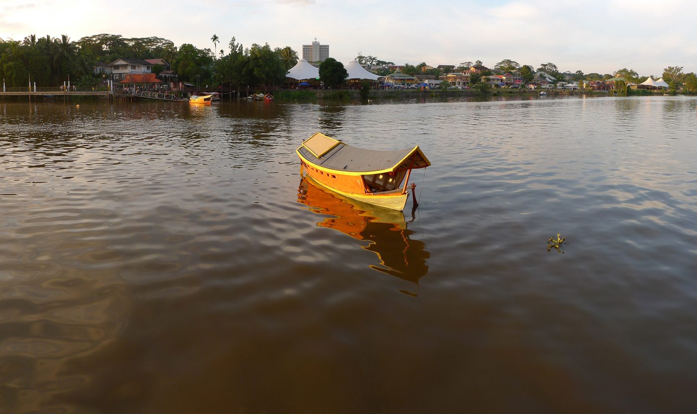
A tambang waiting for passengers等客的 tambang 渡船Tambang menunggu penumpang · Photo: 攝影:Foto: Wong Fook Yee黃福裕Wong Fook Yee, 26 Mar 2013
Where sources disagree各來源說法不一之處Apabila sumber berbeza
City area: 369.48 km² (DBKU) + 61.53 km² (MBKS) = about 431 km²; Wikipedia's infobox gives 450.02 km² (378.20 + 71.82).市區面積:369.48(北市)+ 61.53(南市)= 約431平方公里;維基百科資料框則為450.02平方公里(378.20 + 71.82)。Keluasan bandar: 369.48 km² (DBKU) + 61.53 km² (MBKS) = kira-kira 431 km²; kotak maklumat Wikipedia memberi 450.02 km² (378.20 + 71.82).
City population: 402,738 (a DOSM figure quoted by kuchingborneo.info) or 514,658 (Wikipedia, citing DOSM 2022). Kuching District was 609,205 in the 2020 Census, but Sarawak Facts and Figures 2021 gives 691,300 for 2020.市區人口:402,738(kuchingborneo.info 引用的統計局數字)或514,658(維基百科引用統計局2022年)。古晉縣2020年普查為609,205人,但《砂拉越資料2021》給出的2020年數字是691,300。Penduduk bandar: 402,738 (angka DOSM dipetik kuchingborneo.info) atau 514,658 (Wikipedia, memetik DOSM 2022). Daerah Kuching 609,205 dalam Banci 2020, tetapi Sarawak Facts and Figures 2021 memberi 691,300 untuk 2020.
Which Malaysian city came first? The Borneo Post (2022) says Kuching was the third city, after Kuala Lumpur and Ipoh; Wikipedia's MBKS article says fourth; a UiTM paper says second.古晉是馬來西亞第幾個城市?婆羅洲郵報(2022)說是第三個(次於吉隆坡和怡保);維基百科南市市政局條目說第四個;一篇 UiTM 論文說第二個。Bandar raya keberapa di Malaysia? Borneo Post (2022) kata ketiga, selepas Kuala Lumpur dan Ipoh; rencana Wikipedia MBKS kata keempat; kertas UiTM kata kedua.
Square Tower: 1879 in Sarawak Tourism and most guides; 1886 in the Sarawak Heritage Society's list of gazetted buildings.方塔:砂拉越旅遊局及多數指南說1879年;砂拉越文物協會的憲報建築清單說1886年。Menara Segi Empat: 1879 menurut Sarawak Tourism dan kebanyakan panduan; 1886 dalam senarai bangunan diwartakan Persatuan Warisan Sarawak.
Old Court House: 1874 (heritage list) or 1871 (Old Kuching Smart Heritage trail).舊法院:1874年(文物清單)或1871年(老古晉智慧文物步道)。Mahkamah Lama: 1874 (senarai warisan) atau 1871 (laluan Old Kuching Smart Heritage).
Tua Pek Kong temple: history traced to 1843; "officially" 1876 (Frommer's); possibly before 1839 or about 1820 (other sources).大伯公廟:歷史可追溯至1843年;「官方」說1876年(Frommer's);也有說1839年以前或約1820年。Tokong Tua Pek Kong: sejarah dikesan ke 1843; "rasmi" 1876 (Frommer's); mungkin sebelum 1839 atau kira-kira 1820 (sumber lain).
Great Fire of 1884: about 160 buildings (Amazing Borneo) or more than 190 shops (New Sarawak Tribune, via The Edge).1884年大火:約160座建築(Amazing Borneo)或逾190間店鋪(新砂拉越論壇報,經 The Edge 引述)。Kebakaran Besar 1884: kira-kira 160 bangunan (Amazing Borneo) atau lebih 190 kedai (New Sarawak Tribune, melalui The Edge).
Darul Hana Bridge length: 335 m (designer KTA, SEDC data) or 276 m (Wikipedia infobox).Darul Hana 橋長度:335米(設計公司 KTA、SEDC 資料)或276米(維基百科資料框)。Panjang Jambatan Darul Hana: 335 m (pereka KTA, data SEDC) atau 276 m (kotak maklumat Wikipedia).
Kuching Wetlands National Park: gazetted in 1992 (Wikipedia) or in 2002 (Sarawak visitor guide and Sarawak Forestry).古晉濕地國家公園:1992年憲報(維基百科)或2002年(砂拉越旅遊指南及林業機構)。Taman Negara Tanah Lembap Kuching: diwartakan 1992 (Wikipedia) atau 2002 (panduan pelawat Sarawak dan Perhutanan Sarawak).
Sources: 資料來源:Sumber: Sarawak Heritage Society, list of gazetted heritage, 1 May 2026; Borneo Post (Satok bridge collapse 2004, rebuilt from 2017); UNIMAS thesis on barrage and water quality; Frontiers in Water, 2022; UKAS and Sarawak Ministry of Transport, 2025; Borneo Post, 21 Feb 2010, via Wild Singapore (wetlands impact); Bernama (tambang boatmen); and the sources named in each line of the box.
8
A walk through old Kuching漫步老古晉Berjalan di Kuching lama
A short walk along the south bank, then across the river. The years are those in the sources; see the box in section 7 where they disagree.
沿南岸走一小段,再過河。年份依據資料來源;有分歧之處見第7節的方框。
Berjalan sebentar di tebing selatan, kemudian menyeberang sungai. Tahun mengikut sumber; lihat kotak di bahagian 7 jika ada perbezaan.
A
Kuching Waterfront古晉河濱公園Tebingan Kuching
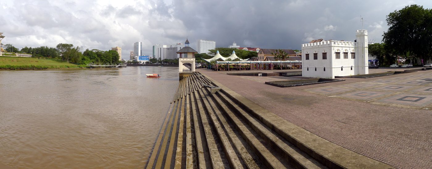
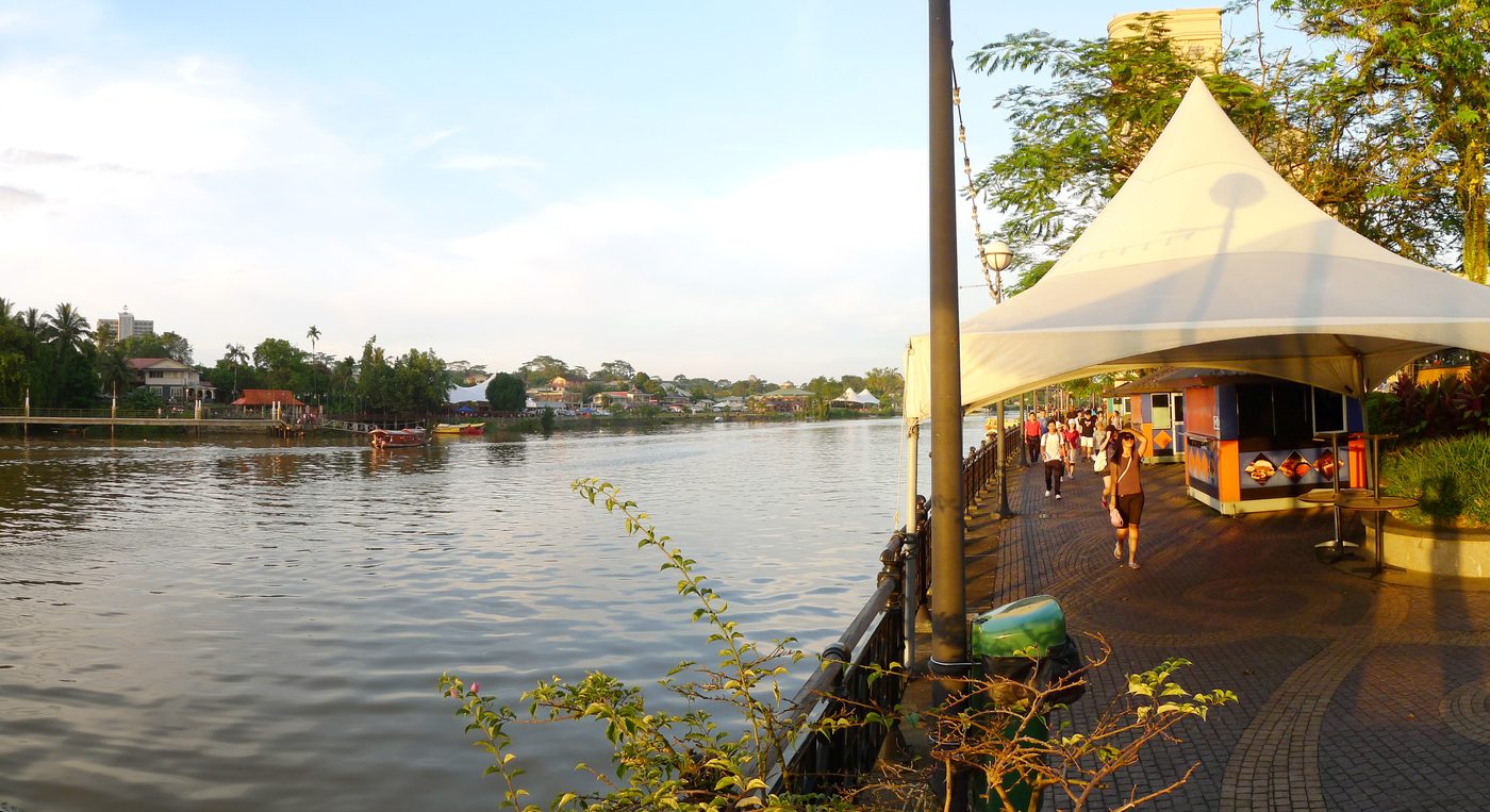
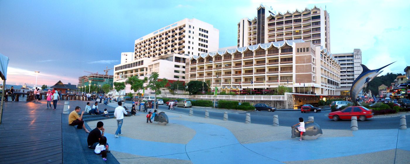
Opened on 4 September 1993 on the old wharves of the south bank — the first waterfront promenade built in Malaysia. From here the Astana, Fort Margherita and the Malay kampungs face you across the water.
Dibuka pada 4 September 1993 di atas dermaga lama tebing selatan — persiaran tebingan pertama dibina di Malaysia. Dari sini Astana, Kubu Margherita dan kampung Melayu kelihatan di seberang air.
Evening on the Waterfront, looking across to the north bank河濱公園的黃昏,望向北岸Petang di Tebingan, memandang ke tebing utara · Photo: 攝影:Foto: Wong Fook Yee黃福裕Wong Fook Yee, 26 Mar 2013
B
Square Tower方塔Menara Segi Empat
Built as a prison and fort beside the Pengkalan Batu landing, where the Rajahs stepped ashore from the Astana. It has also been a mess and a dance hall. Usually dated 1879; gazetted 1971.
建於 Pengkalan Batu 碼頭旁,曾是監獄和堡壘,拉惹從 Astana 渡河後在此上岸。後來也當過食堂和舞廳。一般認為建於1879年;1971年憲報為古蹟。
Dibina sebagai penjara dan kubu di sebelah pangkalan Pengkalan Batu, tempat Rajah mendarat dari Astana. Ia juga pernah menjadi dewan makan dan dewan tari. Biasanya bertarikh 1879; diwartakan 1971.
C
Old Court House舊法院Mahkamah Lama
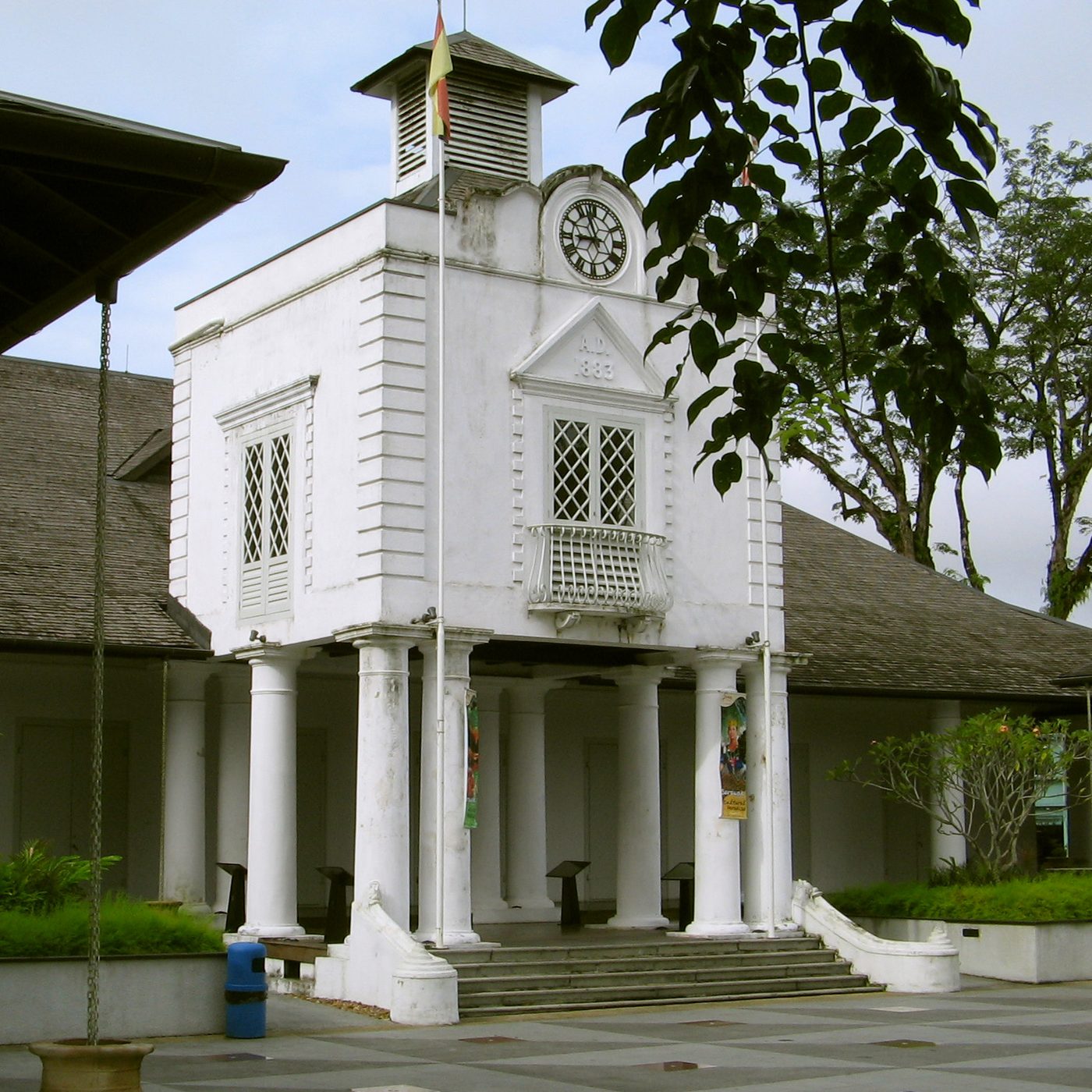
The seat of the Brooke government and the city's main administrative centre from the late 19th century; it now holds the Ranee Museum and cafés. Built 1874 (or 1871); gazetted 1971.
Pusat kerajaan Brooke dan pusat pentadbiran utama bandar sejak akhir abad ke-19; kini menempatkan Muzium Ranee dan kafe. Dibina 1874 (atau 1871); diwartakan 1971.
The clock tower of the Old Court House舊法院的鐘樓Menara jam Mahkamah Lama · Photo: 攝影:Foto: Wong Fook Yee黃福裕Wong Fook Yee, 25 Nov 2005
D
Tua Pek Kong temple大伯公廟Tokong Tua Pek Kong
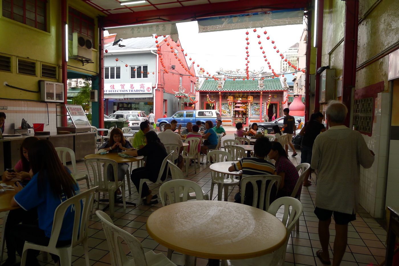
The oldest Chinese temple in Kuching (壽山亭), on the corner opposite the Chinese History Museum. Its history is traced to 1843; it survived the 1884 fire and the Japanese bombing nearby. The Wang Kang festival for the dead is held here.
Tokong Cina tertua di Kuching (壽山亭), di sudut bertentangan Muzium Sejarah Cina. Sejarahnya dikesan ke 1843; ia terselamat daripada kebakaran 1884 dan pengeboman Jepun berhampiran. Perayaan Wang Kang untuk mengenang si mati diadakan di sini.
E
Main Bazaar and Carpenter Street海唇街與亞答街Main Bazaar dan Carpenter Street
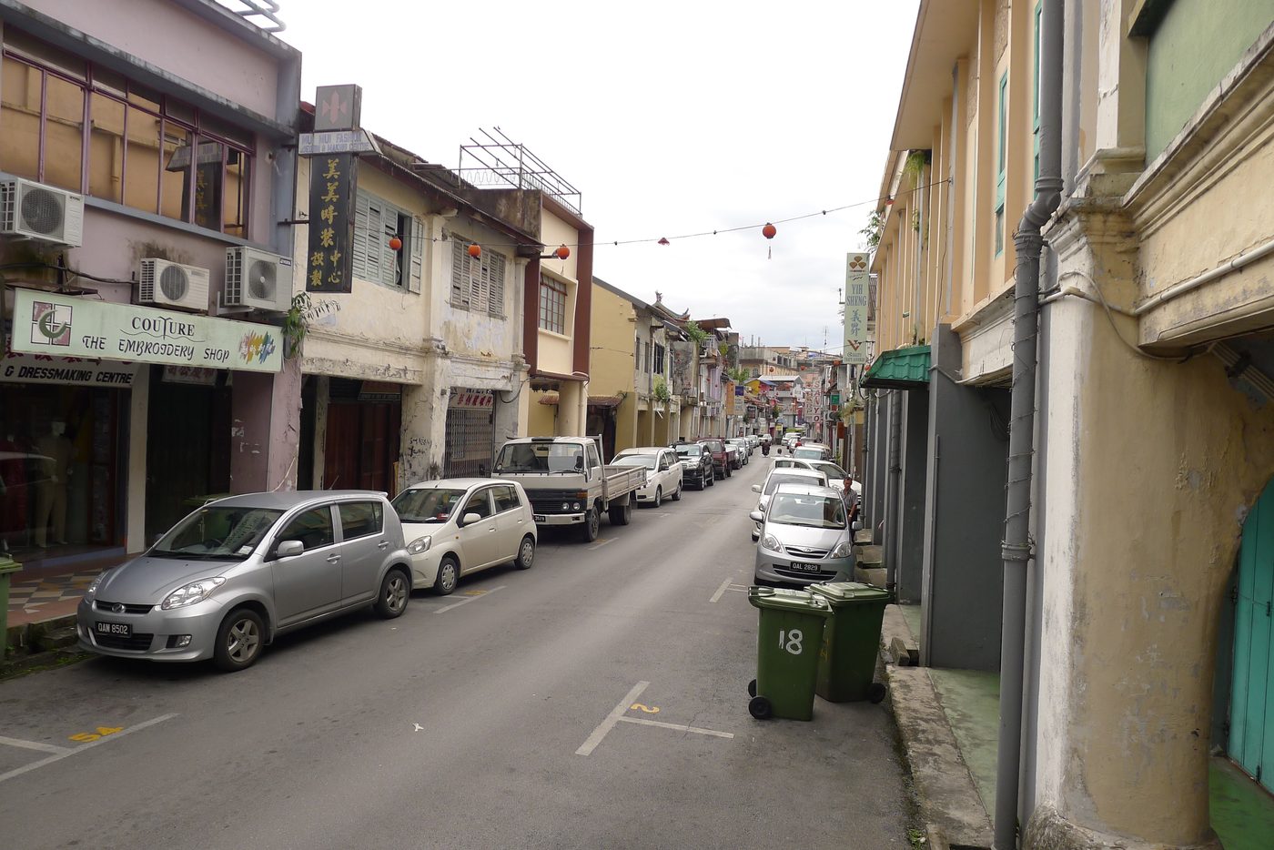
Main Bazaar (1864) is Kuching's oldest street, a row of two- and three-storey shophouses facing the river. Behind it, Carpenter Street was the heart of the Chinese community. After the fire of 1884 the shophouses were rebuilt in brick.
Main Bazaar (1864) jalan tertua Kuching, deretan rumah kedai dua dan tiga tingkat menghadap sungai. Di belakangnya, Carpenter Street pusat masyarakat Cina. Selepas kebakaran 1884 rumah kedai dibina semula dengan batu bata.
Shophouses on Carpenter Street亞答街的店屋Rumah kedai di Carpenter Street · Photo: 攝影:Foto: Wong Fook Yee黃福裕Wong Fook Yee, 4 Feb 2013
F
India Street and the Indian Mosque印度街與印度清真寺India Street dan Masjid India
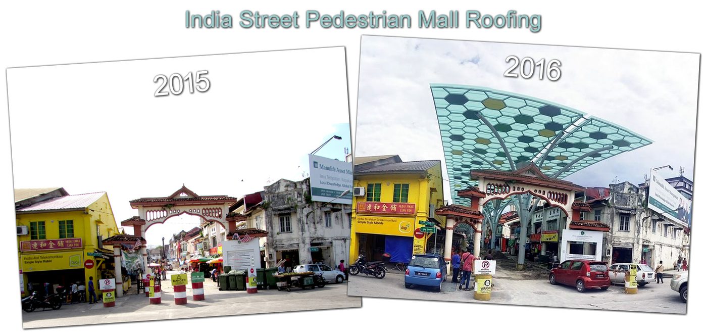
A pedestrian street of cloth and household shops. Through a narrow lane stands the Masjid India, built by Sarawak's Indian Muslim community in 1837 — the oldest intact mosque in Sarawak.
Jalan pejalan kaki dengan kedai kain dan barang rumah. Melalui lorong sempit terdapat Masjid India, dibina oleh masyarakat Islam India Sarawak pada 1837 — masjid tertua yang masih utuh di Sarawak.
India Street before and after its new roof: 2015 (left) and 2016 (right)印度街加蓋屋頂前後:2015年(左)與2016年(右)India Street sebelum dan selepas bumbung baharu: 2015 (kiri) dan 2016 (kanan) · Photo: 攝影:Foto: eTawau, 2015 / 2016
G
Darul Hana BridgeDarul Hana 橋Jambatan Darul Hana
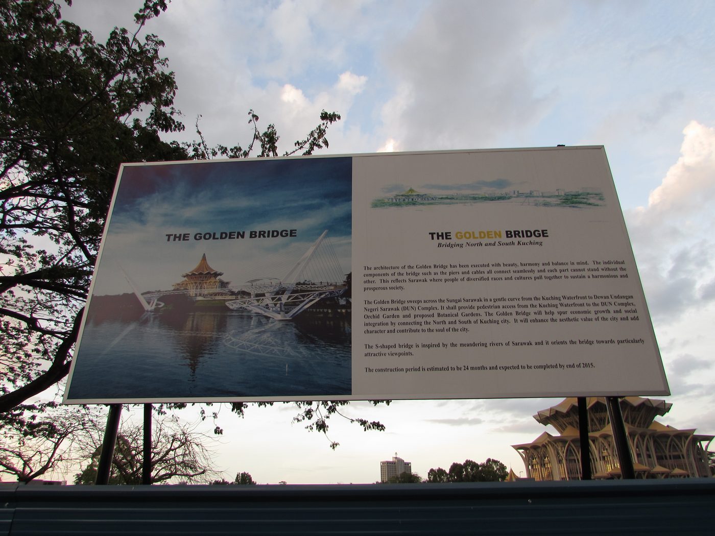
An S-shaped footbridge (RM35 million) from the Waterfront to the new State Legislative Assembly building, opened on 11 November 2017. The design borrows from Bidayuh bamboo bridges; the name means "place of peace".
Jambatan pejalan kaki berbentuk S (RM35 juta) dari Tebingan ke bangunan Dewan Undangan Negeri baharu, dibuka pada 11 November 2017. Reka bentuknya meminjam jambatan buluh Bidayuh; namanya bermaksud "tempat damai".
In 2015 a signboard announced the "Golden Bridge"; it opened in 2017 as Darul Hana Bridge. The new State Assembly building is behind.2015年的告示牌宣佈興建「黃金橋」,2017年以 Darul Hana 橋之名開放。後方是新州議會大廈。Pada 2015 papan tanda mengumumkan "Golden Bridge"; ia dibuka pada 2017 sebagai Jambatan Darul Hana. Bangunan DUN baharu di belakang. · Photo: 攝影:Foto: Wong Fook Yee黃福裕Wong Fook Yee, 12 Apr 2015
H
Across the river: the Astana and Fort Margherita過河:Astana 與瑪格烈達堡Seberang sungai: Astana dan Kubu Margherita
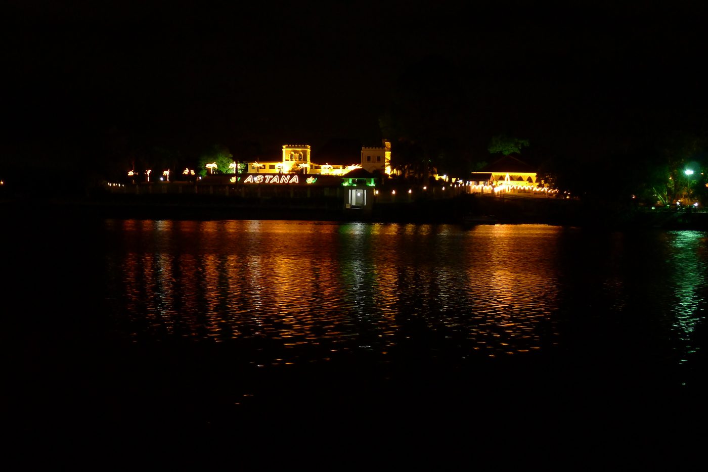
Charles Brooke built the Astana in 1870 as a gift for his bride Margaret; it is now the official home of the Governor. Fort Margherita (1879), named after her, guarded the river approach; it now houses the Brooke Gallery. Both were gazetted in 1971.
Charles Brooke membina Astana pada 1870 sebagai hadiah kepada pengantinnya Margaret; kini kediaman rasmi Yang di-Pertua Negeri. Kubu Margherita (1879), dinamakan sempena beliau, mengawal laluan sungai; kini menempatkan Galeri Brooke. Kedua-duanya diwartakan 1971.
The Astana at night, from the Waterfront從河濱公園看夜晚的 AstanaAstana pada waktu malam, dari Tebingan · Photo: 攝影:Foto: Wong Fook Yee黃福裕Wong Fook Yee, 4 Feb 2013
Sources: 資料來源:Sumber: Wikipedia, "Kuching Waterfront" (4 Sep 1993, first waterfront); Sarawak Tourism, "Explore Kuching heritage in 2 hours" and Old Kuching Smart Heritage; Lonely Planet (Square Tower uses, Old Court House); Sarawak Heritage Society list, 2026; Wikipedia, "Tua Pek Kong Temple, Kuching"; eTawau Main Bazaar page (Wang Kang); The Edge, 2026 (Main Bazaar); Sarawak visitor guide 2014 (Masjid India 1837); Malay Mail, 12 Nov 2017 and emily2u (bridge); Frommer's (Astana, Fort Margherita); Lonely Planet / Patrick Comerford (Brooke Gallery).
9
East Malaysia's three cities, nearby places and more eTawau pages東馬三城、鄰近地方與更多 eTawau 頁面Tiga bandar raya Malaysia Timur, tempat berdekatan dan halaman eTawau lain
Malaysia's federal government gives city status (bandar raya) to only a few towns. In East Malaysia there are three: Kuching, Kota Kinabalu and Miri. eTawau has a page on each.
Kerajaan persekutuan Malaysia memberi taraf bandar raya kepada beberapa pekan sahaja. Di Malaysia Timur ada tiga: Kuching, Kota Kinabalu dan Miri. eTawau ada halaman bagi setiap satu.
Sarawak
Kuching古晉Kuchingyou are here本頁halaman ini
City since 1 August 19881988年8月1日升格為市Bandar raya sejak 1 Ogos 1988
Capital of Sarawak, on the tidal Sarawak River. A Brunei settlement of 1827 that became the seat of the Brooke Rajahs; two councils (DBKU north, MBKS south).
Ibu negeri Sarawak, di tebing Sungai Sarawak yang berpasang surut. Penempatan Brunei 1827 yang menjadi pusat pemerintahan Rajah Brooke; dua majlis (DBKU utara, MBKS selatan).
Sabah
Kota Kinabalu亞庇Kota Kinabalu
City since 2 February 20002000年2月2日升格為市Bandar raya sejak 2 Februari 2000
Capital of Sabah, on Gaya Bay facing the islands of Tunku Abdul Rahman Park. Founded as Jesselton in 1899 after the Gaya Island post was burned; one council (DBKK).
Ibu negeri Sabah, di Teluk Gaya menghadap pulau-pulau Taman Tunku Abdul Rahman. Diasaskan sebagai Jesselton pada 1899 selepas pos Pulau Gaya dibakar; satu majlis (DBKK).
City since 20 May 20052005年5月20日升格為市Bandar raya sejak 20 Mei 2005
The oil town: Malaysia's first oil well, the "Grand Old Lady" on Canada Hill, struck oil in December 1910. The first Malaysian city that is not a state capital.
石油城:馬來西亞第一口油井 —— 加拿大山上的「老油井」(Grand Old Lady)於1910年12月出油。美里是馬來西亞第一個非州首府的城市。
Bandar minyak: telaga minyak pertama Malaysia, "Grand Old Lady" di Bukit Kanada, menemui minyak pada Disember 1910. Bandar raya pertama Malaysia yang bukan ibu negeri.
Sources: 資料來源:Sumber: Borneo Post, 1 Aug 2022 (Kuching); Wikipedia, "Kota Kinabalu City Hall" (2 Feb 2000); Wikipedia, "Miri" (20 May 2005; Sarawak Tourism and the 2014 Sarawak Visitors' Guide give 13 May 2005); Wikiwand, "Miri, Sarawak" (oil struck 22 Dec 1910); Wikipedia, "Miri" (first non-state-capital city).
Near Kuching古晉附近Berhampiran Kuching
Division省Bahagian
Kuching Division古晉省Bahagian Kuching
Land and water, ecosystems and farming of the whole division — Kuching, Bau and Lundu districts.
整個古晉省的土地與水、生態與農業 — 古晉、石隆門與倫樂三縣。
Tanah dan air, ekosistem dan pertanian seluruh bahagian — daerah Kuching, Bau dan Lundu.
Hotels, shopping malls and clinic price lists that were on the old version of this page have been left out: that information changes quickly and is easy to find elsewhere.
本頁舊版中的酒店、購物商場和診所價目已刪除:這些資料變化快,在別處也容易找到。
Hotel, pusat beli-belah dan senarai harga klinik yang ada dalam versi lama halaman ini telah dibuang: maklumat itu cepat berubah dan mudah didapati di tempat lain.
10
Photos照片Foto
From a coffee shop on Carpenter Street, looking across to the temple從亞答街的咖啡店望向對面的廟宇Dari kedai kopi di Carpenter Street, memandang ke tokong di seberang · Wong Fook Yee黃福裕Wong Fook Yee, 4 Feb 2013An old shop on Carpenter Street亞答街的一間老店Kedai lama di Carpenter Street · Wong Fook Yee黃福裕Wong Fook Yee, 4 Feb 2013
Tap a photo to see it full screen. Do you have photos of Sama Jaya Nature Reserve, the Kuching Wetlands, Bukit Siol or the barrage? Please email us eTawau@yahoo.com.
點擊照片可全螢幕瀏覽。如果您有 Sama Jaya 自然保護區、古晉濕地、Bukit Siol 或閘壩的照片,請電郵 eTawau@yahoo.com。
Ketik foto untuk lihat skrin penuh. Ada foto Rizab Alam Sama Jaya, Tanah Lembap Kuching, Bukit Siol atau benteng? Sila e-mel eTawau@yahoo.com.
Earlier eTawau pages used here: Vanishing Kuching, Main Bazaar, the aerial-view pages and Wong Fook Yee's photographs.
本頁也參考了 eTawau 早期的頁面:《消失中的古晉》、海唇街、空照頁面,以及 Wong Fook Yee 的照片。
Halaman eTawau terdahulu yang digunakan: Vanishing Kuching, Main Bazaar, halaman pandangan udara dan foto Wong Fook Yee.
Know something we got wrong or missed? Please email us eTawau@yahoo.com發現錯誤或遺漏?請電郵 eTawau@yahoo.comAda maklumat yang salah atau tertinggal? Sila e-mel eTawau@yahoo.com